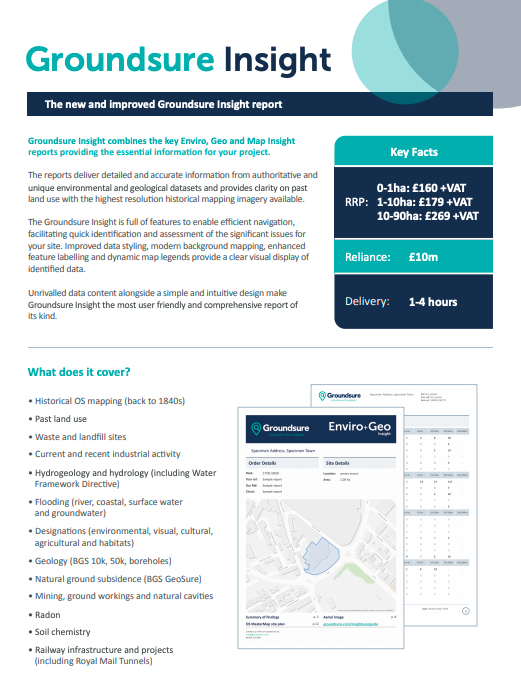
Groundsure Insight provides three key Enviro, Geo and Map Insight reports, combining essential information for your project.
Available as PDF and raw data for GIS.
The reports deliver detailed and accurate information from authoritative and unique environmental and geological datasets and provide clarity on past land use with the highest resolution historical mapping imagery available.
The Groundsure Insight is full of features to enable efficient navigation, facilitating quick identification and assessment of the significant issues for your site. Improved data styling, modern background mapping, enhanced feature labelling and dynamic map legends provide a clear visual display of identified data.
Unrivalled data content alongside a simple and intuitive design make the Groundsure Insight the most user friendly and comprehensive report of its kind.
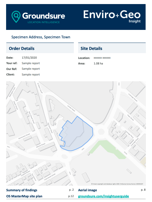
SAMPLE REPORT
View a sample report before you commit to purchase. See the simple layout.
Historical Land Use Database (HLUD) included free as standard
Pollution inventory data
Recent and historical aerial imagery
Includes Fire Insurance Plans as standard, free of charge, where available
Environmental Permits, Incidents and registers
Hydrology and Hydrogeology data including abstractions, source protection zones (SPZ), now with SPZ within confined aquifers
Detailed flood data
Royal Mail Tunnels data
PRICES
0-1ha: £160+vat
1-9ha: £179+vat
10-90ha: £269+vat
KEY BENEFITS
No busy zip file and constant switching between files in review. Provided in only 3 PDF files; the data report and the large and small-scale historical maps
Unrivalled data content. Many unique and proprietary datasets are included that are available nowhere else
Time-saving. In-report navigation and UX features speed up review by 20%**
* Up to 10 ha. Reliance: £10m Professional Indemnity Insurance (any one claim). Can be relied upon by all professional parties within a property transaction, first purchasers / tenants and their advisers. Please refer to Groundsure terms & conditions. Average turnaround times are 1-4 hours for sites up to 10ha.
** Estimate from survey of environmental consultants.
OTHER GROUNSURE PRODUCTS
GROUNDSURE ENVIRO INSIGHT
An essential part of Environmental Consultant’s desk study. Available as PDF and raw data for GIS.