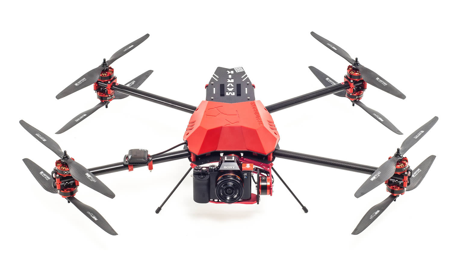
UAV DRONE SURVEYS
We are GeoSpatial Data experts. Providing accurate & meaningful UAV Drone surveys throughout the UK is our specialism.
Services include Aerial Mapping, 3D Models, Height Data, Point Cloud, Thermal Imaging, NDVI & Structural Inspections etc.
Partnering with Geo-4D; drone flight & data experts adds an unrivalled level of geomatics professionalism.
UAV DRONE DATA DELIVERABLES
What data can you get from a drone? Flying is the easy part. Turning UAV Drone Data into meaningful information is what we do best.
Aerial Imagery.
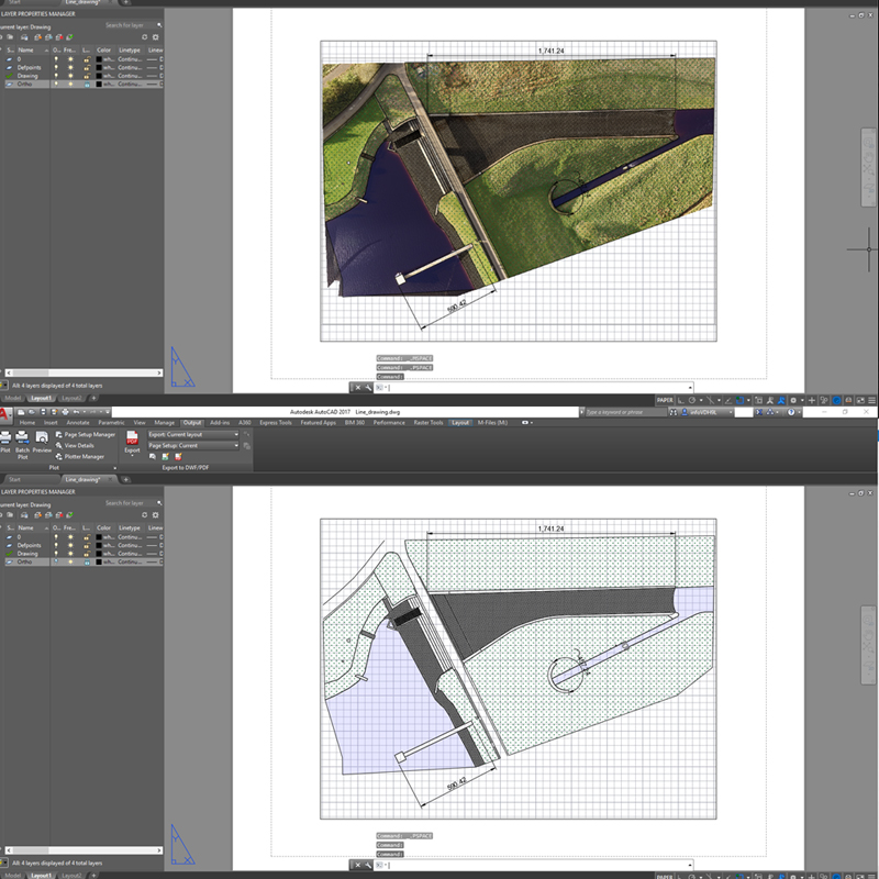
Drones capture 100s of images per flight. We stitch them together to provide a single seamless aerial photo called an orthomosaic.
3D Models.
3D models are a great way to visualise your area of interest & we can output in many formats to suit your software.
Mapping.
Take mapping into your own hands for urban planning, terrain modelling, large scale mapping, asset management and much more.
Height Data.
Digital Terrain Models give understanding to the topography of the land.
3D MODELS FROM UAV DRONES from UAV
Press “Play” & click around this interactive model we created from a UAV Drone scan. Begin to understand the art of the possible.
3D deliverable generated during a multispectral survey. This data can be used in conjunction with the Vegetation Index maps to analyse crops.
UAV Drones can be flown over a site to output highly detailed and accurate 3D models in post production.
-
Site up to 25ha
-
Includes 1 Pilot, 1 Surveyor, 1 UAV
-
Includes: Ortho Aerial Image, GPS Ground Control Points, 3D Model, DTM & DSM Height Data, Point Cloud
-
2 weeks from Quote to Delivery
INDICATIVE PRICING
UAV Drone Surveys & Inspections from Joanna James offer fantastic value & reflect a highly professional & accurate service delivered by GeoSpatial experts.
All jobs are risk assessed, insured & only utilise fully CAA qualified pilots with relevant airspace clearances & permissions.
Prices shown are indicative only. We take time to carefully understand your needs & desired outcomes.
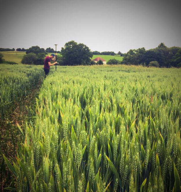
UAV DRONE ACCURACY MATTERS
As Geomatics experts Joanna James & our partners Geo-4D know how to get the best accuracy out of UAV Drones. GPS Ground Control Points using RTK kit can be gathered on site to ensure precision.
It really is horses-for-courses; not every job demands such accuracy.
We take time to discuss your needs & expected outputs to deliver exactly what you want, first time.
ORTHOMOSAIC AERIAL IMAGERY
This image is 100s Aerial Photos “stitched” together providing an incredible contemporary view of an Aldi Superstore.
Joanna James UAV Drone Surveys capture 100s of photos at regular intervals & at similar altitudes. Using the latest software & our Geomatics expertise we output quality orthomosaic aerial images.
Conducting regular UAV scans can build a picture of change over time.
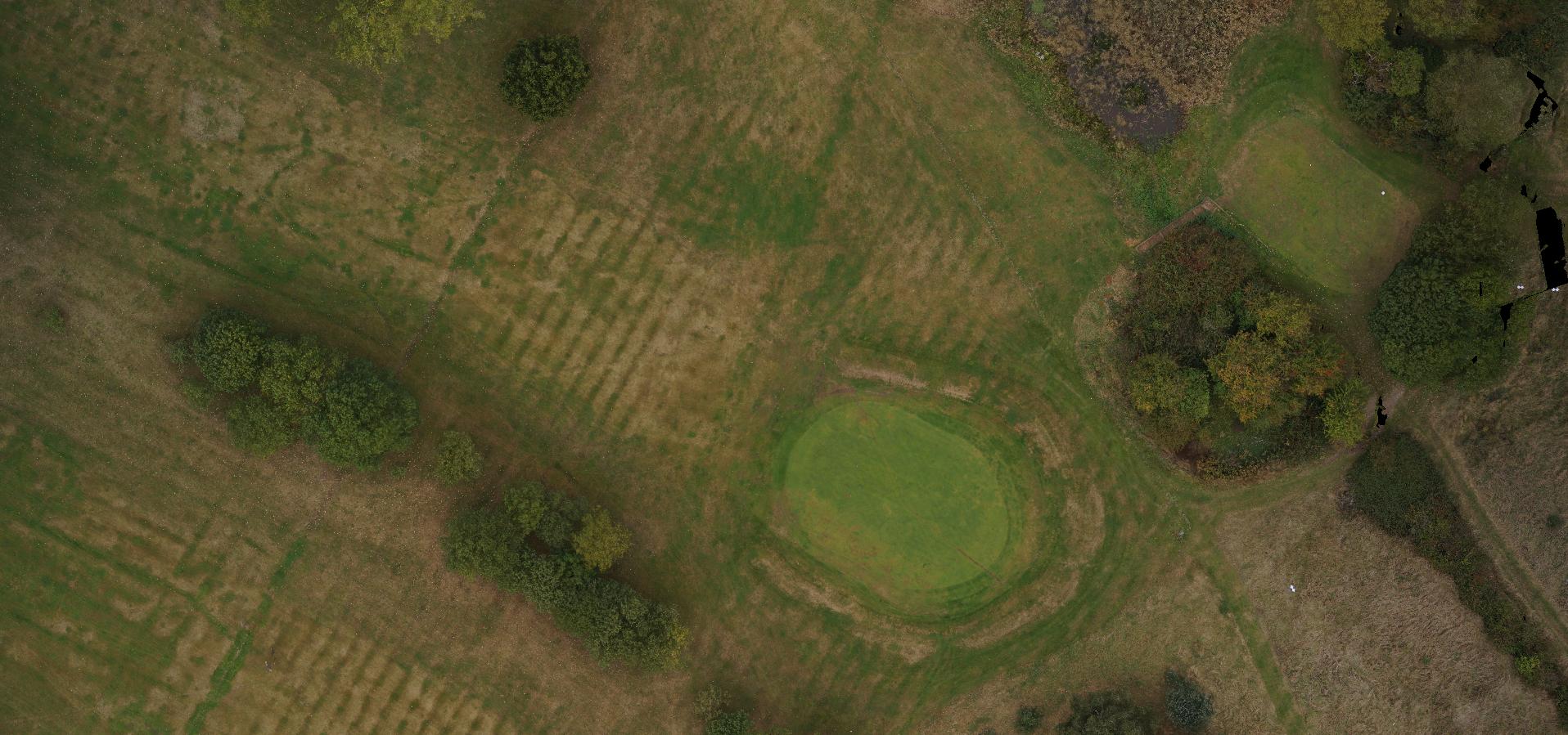
HEIGHT DATA DSM
Get deeper insights to your site. This golf course UAV Drone survey shows clearly how much more information can be obtained.
Original UAV Drone Survey.
This typical Aerial Photo of a golf course green gives a typical indication of what the site looks like from above. But there is so much more that can be obtain from UAV Drone surveys & inspections.

DSM.
Digital Surface Models (DSM) give indicative topographical measurement of any site. The golf course green is clearly visible. Utilising this height data in CAD or GIS gives real world height measurements to help with any project.