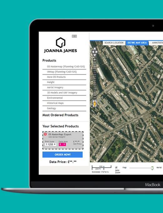
Map Insight provides the highest quality imagery on the market as standard. Available as PDF and Geotiffs.
The historic Ordnance Survey mapping is scanned in at over 500 dots per inch (dpi), setting a new industry standard. This sharper imagery means the information is clearer enabling greater confidence in your opinion.
The maps date back to the 1840s to provide detailed insight into historical land use to understand the potential contaminated land risks and associated liabilities.
We also include detail from the original marginalia information such as surveyed, leveled and copyright dates.
This additional inspection ensures you have everything you need to provide an accurate and informed opinion.
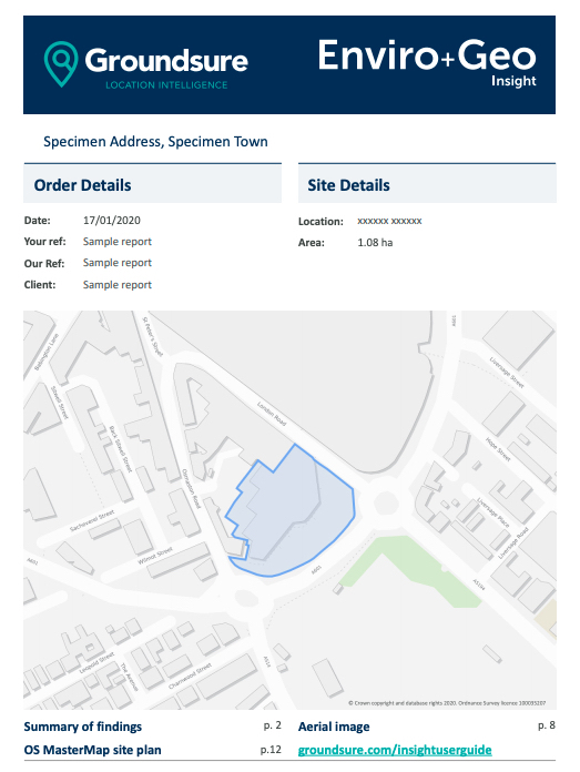
SAMPLE REPORT
View a sample report before you commit to purchase. See the simple layout.
Choose from three formats which can include both National Grid and County Series maps:
Full pack, including town plans: Available scales include 1:10,000, 1:10,560, 1:2,500, 1:1,250, 1:1056 and 1:500
Small scale: Available scales include 1:10,000 National Grid and 1:10,560 County Series and now includes mapping from 2001, 2010 and 2019
Large scale, including town plans: Available scales include County Series 1:1056 and 1:500, National Grid at 1:1,250 and both at 1:2,500 and now includes Landline from 2003
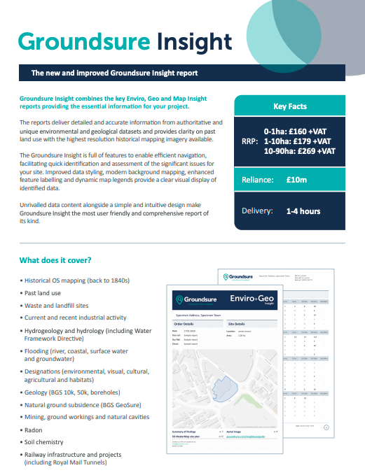
PRICES
0-1ha: £70+vat
1-10ha: £85+vat
10-90ha: £145+vat
*Reliance: £10m Professional Indemnity Insurance (any one claim). Can be relied upon by all professional parties within a property transaction, first purchasers / tenants and their advisers. Please refer to our terms and conditions. **Average turnaround times are 1-4 hours for sites up to 10ha.
OTHER GROUNDSURE REPORTS
GROUNDSURE INSIGHT
Combines three key Enviro, Geo and Map Insight reports, combining essential information for your project.