We are 2D & 3D specialists providing Digital Construction Data to Architects, Planners, Developers and Civil Engineers etc involved in developing the built environment.
Specifically, we supply highly cost effective Ordnance Survey Mapping, 3D Models, CGI Visualisations, Utility Reports, Height & LiDAR Data, Aerial Photos & Land & Building Surveys.
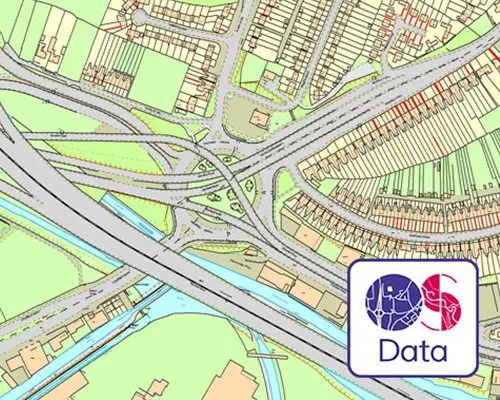
ORDNANCE SURVEY MAPS
We are proud partners of Ordnance Survey. Delivering the most up to date OS Mapping for instant download from Map Portal.
CGI Site Plans are a great way to show your development in one image. Also known as 3D site plan, or aerial cgi, these images are created by modelling the development in 3D.
See the future set against the existing. 2D proposal drawings transformed into a 3D render & seamlessly superimposed onto a photograph of the current environment.
Digital Historical Mapping dating back to the 1800s enables you to actively track the development of your site over time. Delivered in chronological PDFs.
Beautifully handcrafted Architectural Physical Models that are a tangible physical representation of a structure. Ideal for design process & marketing.
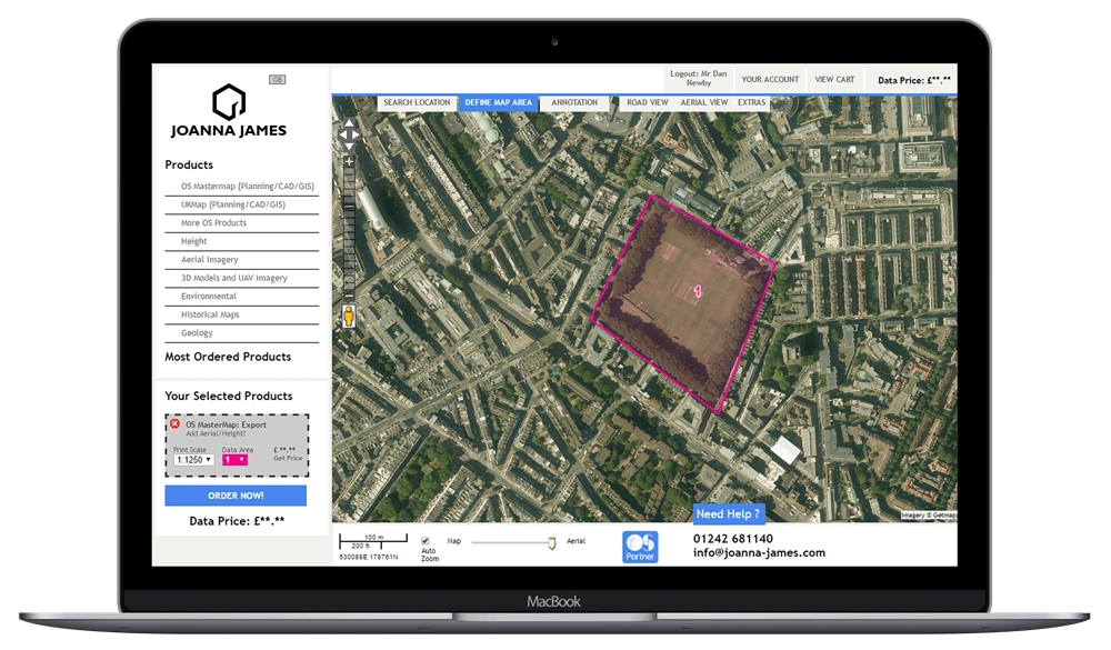
Users can search, locate, mark out sites, order & download a wide range of maps & data. Including Ordnance Survey MasterMap, Aerial Photos, Height & LiDAR Data, Geology & Environmental Maps.
Map Portal is free to join, doesn’t require any software downloads or installations, use any web browser (Google Chrome, Internet Explorer, Firefox Safari) via Apple Mac or PC & works anywhere in the world 24/7. Here’s what can be instantly downloaded:
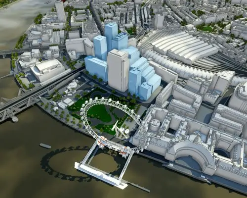
We’re delighted to offer digital 3D models of several larger-area cities with incredible savings to be had for end users. Save big-time by purchasing from a selection of pre-built 3D models of various UK cities.
Location is a crucial part of decision making. Start with Ordnance Survey Mapping for planning applications. Bring designs to life by commissioning a 3D Model to impress clients & convince planning authorities.
WE’RE AT THE START OF EVERY PROJECT
Location is a crucial part of decision making. Start with Ordnance Survey Mapping for planning applications. Bring designs to life by commissioning a 3D Model to impress clients & convince planning authorities.
PLANNING MAPS
We will help to ensure that your Planning Application is not delayed or rejected by the Local Planning Authority because of discrepancies or unlicensed usage with your site location plans.
Ordnance Survey MasterMap available to download from Map Portal is 100% Planning Portal & Local Planning Authority compliant.
HERE FOR BUILT ENVIRONMENT PROS
Our clients typically work within the construction industry. Often they are Architects, Landscape Architects, Planners, Developers or Civil Engineers. As a matter of fact we help with the projects of smaller independent companies and multi-national AJ100 practices.
We provide cost effect digital construction data to the construction industry. No matter the budget.
")


")
")


")