The GroundsureGeo Insight Report provides a detailed geological data report combining BGS data with unique geological and geo-hazard datasets.
Available as PDF & raw data for GIS.
An essential report for geo-environmental professionals looking to identify potential ground instability problems that may affect ground investigation, foundation design or possible remediation options.
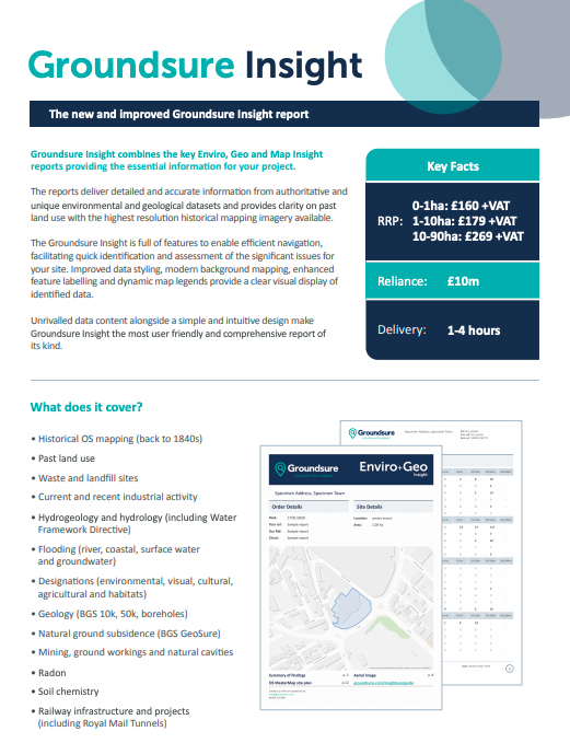
Groundsure Geo Insight is full of features to enable efficient navigation, facilitating quick identification and assessment of the significant issues for your site. Improved data styling, modern background mapping, enhanced feature labelling and dynamic map legends provide a clear visual display of identified data.
10k BGS geology data is provided as standard alongside comprehensive geological data from a variety of sources. Also includes unique ground workings data derived from Groundsure’s collection of historical OS maps, and railway infrastructure data including tunnel locations and depths for both the London Underground and the Royal Mail Tunnels.
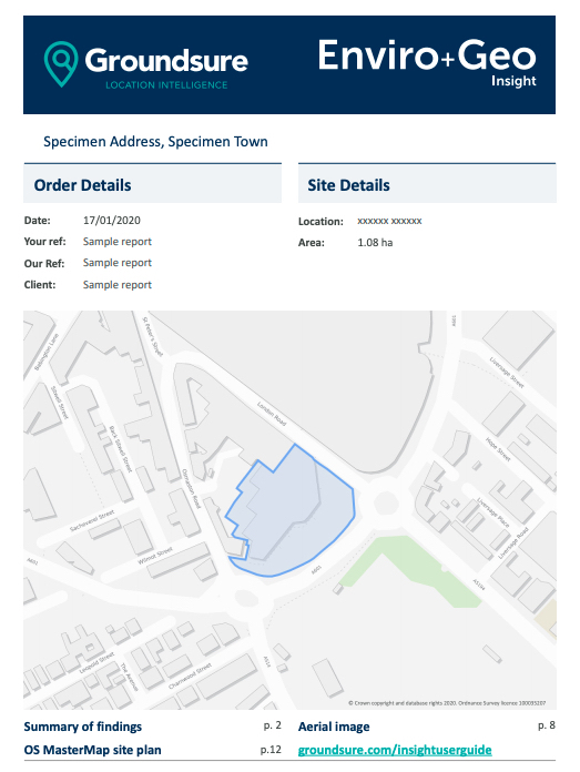
SAMPLE REPORT
View a sample report before you commit to purchase. See the simple layout.
Detailed BGS records of artificial, superficial and bedrock geology at 1:50,000 and 1:10,000 scale (where available)
Bedrock permeability and faults
Groundsure’s unique historical surface and underground workings database
Mining ground workings and natural cavities data
Royal Mail Tunnels data
BGS non-coal mining hazards data
Site specific radon information
PRICES
0-1ha: £30+vat
1-9ha: £35+vat
10-90ha: £50+vat
KEY BENEFITS
In-depth data and product sets
10k geology included as standard. The highest geological mapping giving the greatest certainty about ground conditions at a site.
Bespoke reports and data available with report packages tailored to your specific requirements
Time saving. In-report navigation and UX features speed up review by up to 20%**
*Reliance: £10m Professional Indemnity Insurance (any one claim). Can be relied upon by all professional parties within a property transaction, first purchasers / tenants and their advisers. Please refer to our terms and conditions. Average turnaround times are 1-4 hours for sites up to 10ha.
** Estimate from survey of Environmental consultants
OTHER GROUNDSURE REPORTS
GROUNDSURE INSIGHT
Combines three key Enviro, Geo and Map Insight reports, combining essential information for your project.