Planning applications in the UK rely on clear communication.
Architectural drawings provide technical detail, yet many stakeholders struggle to visualise how a proposed building will appear once constructed. Planning officers, committee members and local residents must understand the real impact of a development before permission can be granted.
This is why CGI visualisations for planning applications UK have become an essential part of modern planning submissions.
Photorealistic CGI images translate architectural plans into realistic visuals that show exactly how a project will sit within its surroundings. They allow decision makers to evaluate scale, design and visual impact quickly.
For developers, architects and planning consultants, these visuals often strengthen planning submissions and improve the clarity of proposals submitted to local authorities.
If you want to see real examples of planning-ready visuals, explore
CGI Visualisation Services
Why CGI Visualisations Matter in UK Planning Applications
Planning officers assess a wide range of factors when reviewing development proposals.
These include:
• architectural quality
• building scale
• visual impact on the surrounding area
• neighbourhood character
• integration with existing infrastructure
Technical drawings alone rarely communicate these factors clearly.
CGI planning visuals solve that problem by presenting developments in a realistic and understandable format.
A high quality planning visual can show:
• the building within its real streetscape
• the relationship to neighbouring properties
• landscaping proposals
• pedestrian viewpoints
• architectural materials and design features
This visual clarity helps planners interpret proposals faster and with greater confidence.
How CGI Visualisations Improve Planning Approval Success
While visuals do not guarantee planning permission, they often improve how proposals are understood.
Several factors explain why CGI imagery is valuable during planning.
Clear Representation of Building Scale
Architectural elevations provide measurements and proportions.
However, scale can still be difficult for non specialists to interpret.
CGI renders illustrate how tall or prominent a development will appear within its surroundings.
This helps planning authorities evaluate:
• overshadowing
• building massing
• skyline impact
• relationship to nearby properties
When scale is clearly communicated, planning officers can assess proposals more efficiently.
Better Communication With Communities
Public consultation is often required for larger developments.
Residents may review planning documents but struggle to interpret technical drawings.
CGI imagery helps residents understand proposals instantly.
Visualisations can show:
• proposed housing layouts
• streetscape integration
• landscape improvements
• the overall appearance of new buildings
Clear visuals reduce misunderstanding and encourage more constructive community feedback.
Stronger Planning Documentation
Planning submissions typically include supporting reports such as:
• Design and Access Statements
• Heritage Statements
• Landscape and Visual Impact Assessments
• Environmental Impact Assessments
CGI visuals support these documents by providing visual context.
For example, a Design and Access Statement may describe how a building integrates with its environment. A CGI render demonstrates that relationship clearly.
The UK Government’s design guidance for planning applications emphasises the importance of clear and effective design communication.

Key Elements of High-Quality Planning CGI
Not all architectural renders are suitable for planning submissions.
Planning CGI must prioritise accuracy and context.
Professional visualisation studios combine several data sources to produce reliable imagery.
Architectural 3D Modelling
Architectural drawings are converted into detailed 3D models.
These models ensure the building’s proportions, materials and design features accurately match the architectural plans.
This modelling stage forms the foundation of realistic planning visuals.
Ordnance Survey Mapping Integration
Accurate location context is essential for planning imagery.
Many CGI studios integrate Ordnance Survey mapping data to ensure developments are positioned correctly within their environment.
OS mapping provides geographic reference for:
• surrounding buildings
• roads and infrastructure
• land boundaries
• terrain levels
More information on UK mapping standards can be found via Ordnance Survey mapping and geographic data resources.
Realistic Environmental Context
Planning visuals must represent the real environment.
This may include:
• surrounding houses
• existing street layouts
• vegetation and landscaping
• public spaces
Combining architectural modelling with site photography helps create realistic planning perspectives.

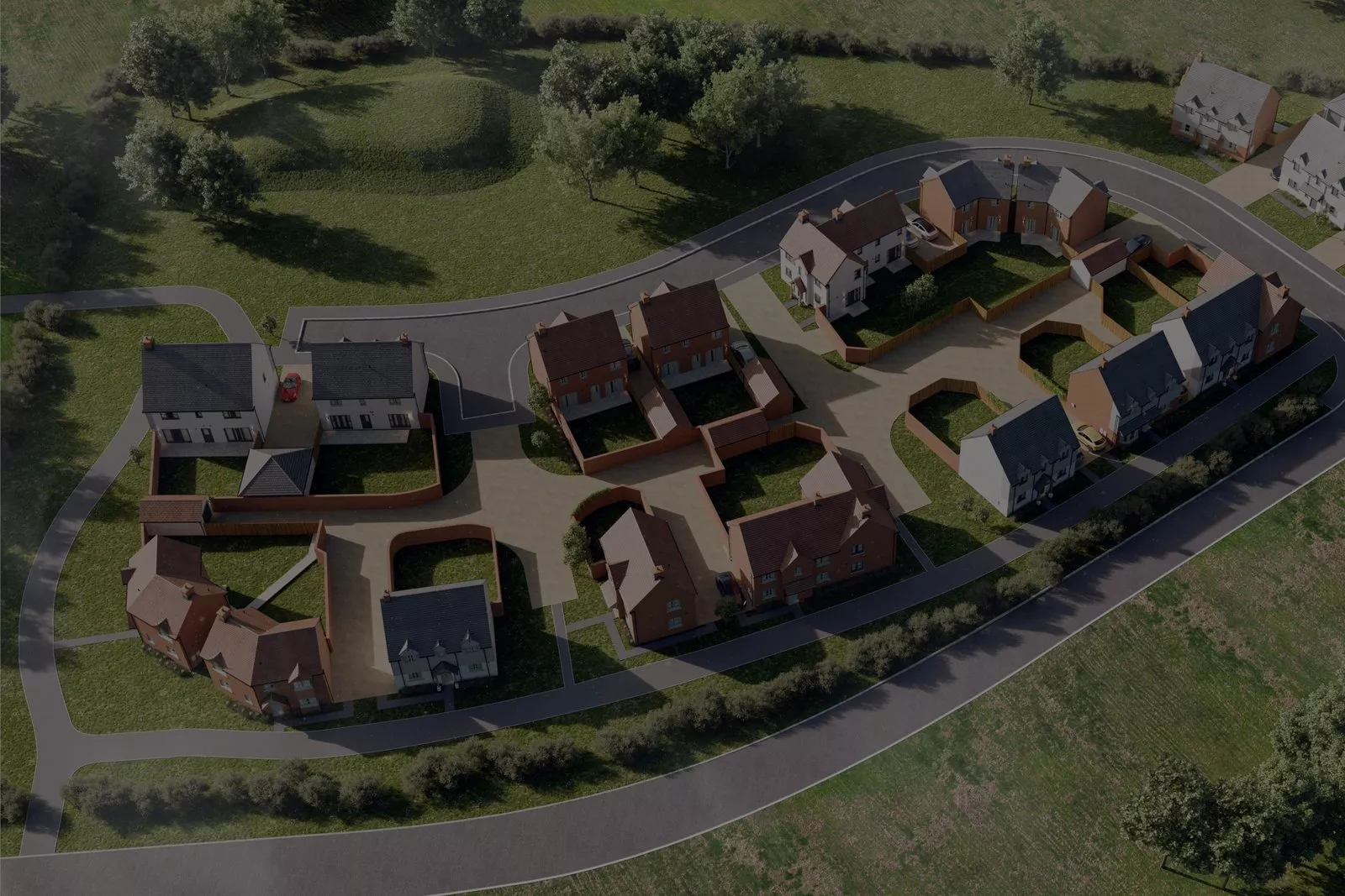
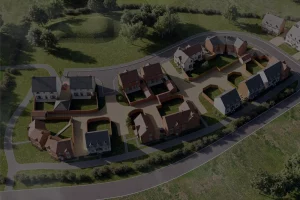
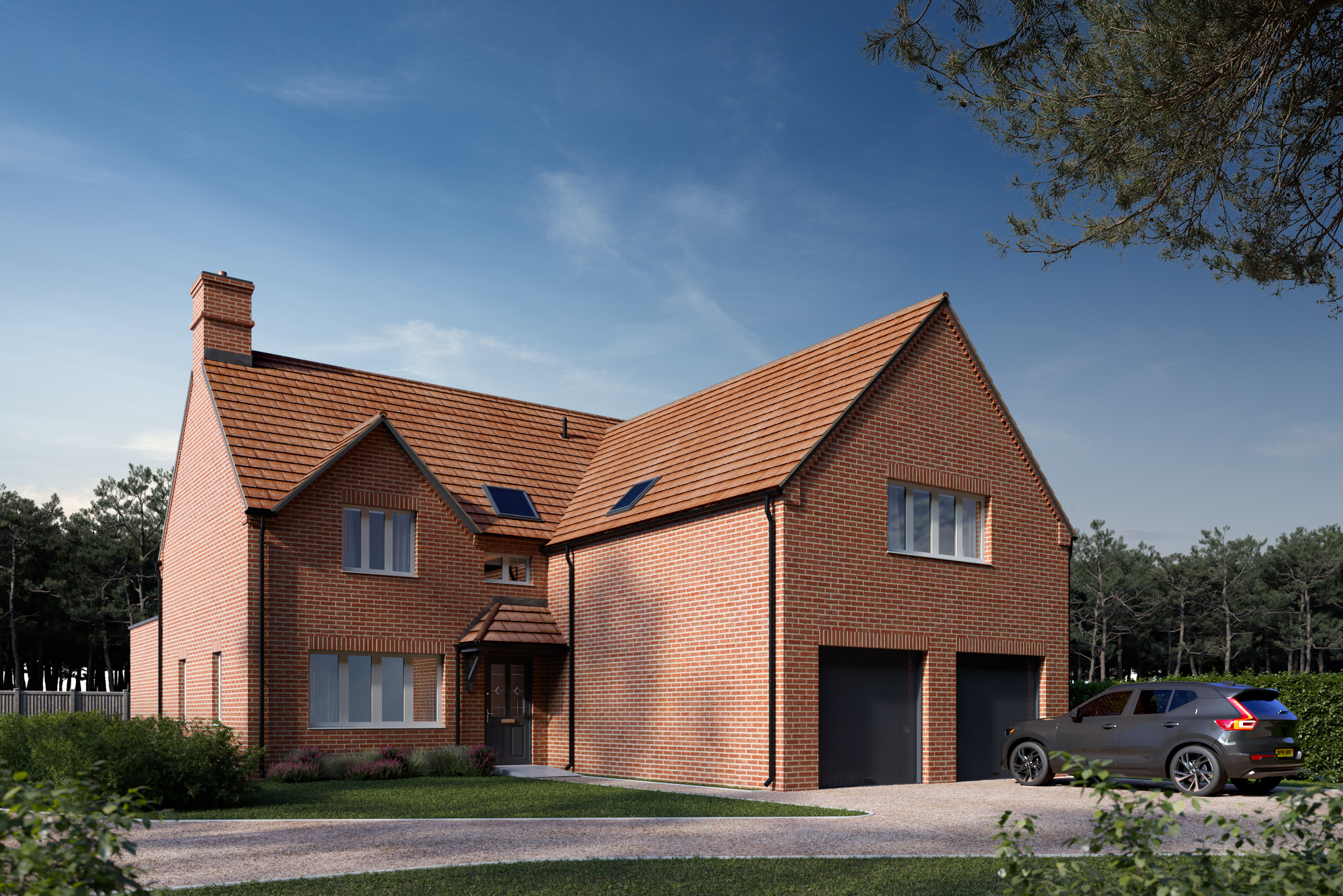
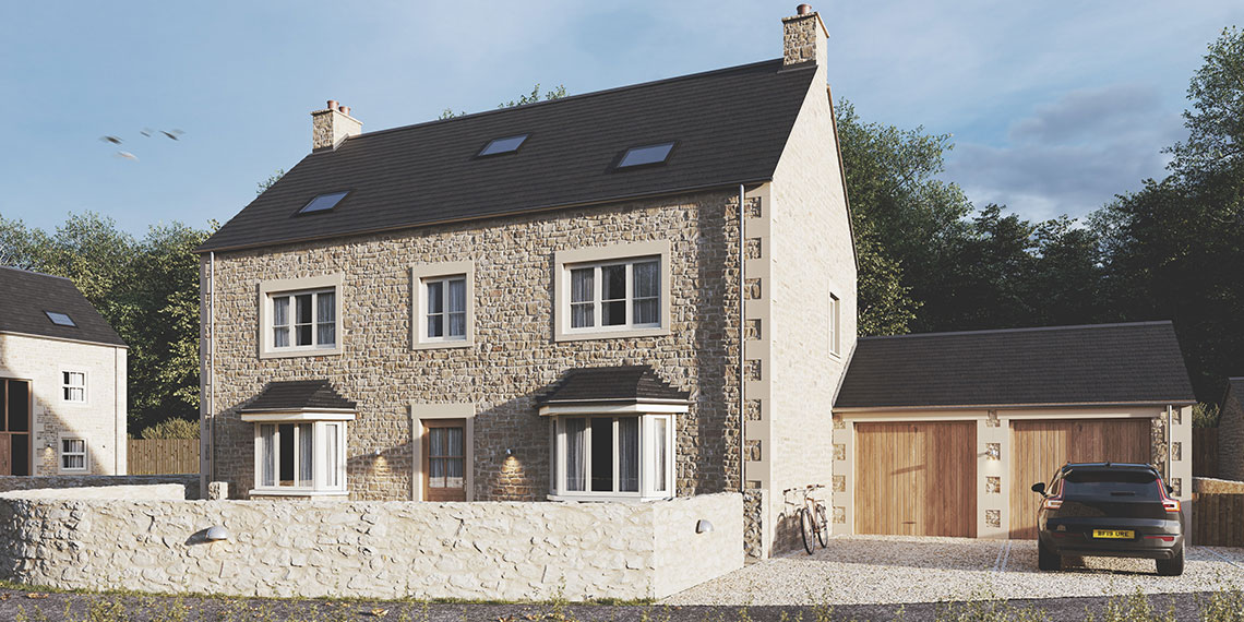
CGI Visualisations for Residential Developments
Housing developments rely heavily on CGI imagery during the planning stage.
Local planning authorities evaluate how new housing will affect neighbourhood character.
Planning visuals help demonstrate:
• housing density
• street design
• architectural style
• landscape integration
Residential CGI images also serve a second purpose.
Once planning permission is granted, developers often reuse these visuals for property marketing.
Examples of residential CGI can be seen here:
New Build Development CGI Visuals
Mapping and Spatial Data in Planning Visualisations
Accurate CGI depends on reliable spatial data.
Mapping information ensures developments are positioned correctly relative to the surrounding environment.
Key datasets often include:
• topographic surveys
• Ordnance Survey mapping layers
• terrain models
• site boundary data
Many planning teams manage this information through digital mapping platforms.
Joanna James provides a central mapping platform designed for development teams.
Explore the platform here: Joanna James Map Portal
When Should CGI Visualisations Be Created?
Timing is important for planning visuals.
Ideally, CGI imagery should be produced during the planning preparation phase, once the architectural concept is established.
At this stage:
• building massing is defined
• key design elements are known
• planning documents are being prepared
Creating visuals early allows them to support multiple elements of the planning submission.
Late stage visuals are less effective because they cannot strengthen supporting documents.
Professional CGI vs Basic Visualisations
Some planning teams attempt to produce simple visuals internally.
However, professional planning CGI requires specialist expertise.
Professional visualisation studios combine:
• architectural modelling
• mapping data
• survey information
• environmental context modelling
This ensures the final imagery accurately represents the development.
Poor or inaccurate visuals can create confusion during planning reviews.
High quality CGI strengthens credibility and improves how proposals are understood.
Frequently Asked Questions
CGI visuals are not mandatory for every planning submission. However, they are commonly used for medium and large developments because they help planning officers evaluate proposals clearly.
Most planning applications include three to eight CGI viewpoints showing the development from different perspectives.
Yes. Clear visuals reduce confusion during public consultation. When residents understand the proposal visually, discussions focus on the real design rather than assumptions.
Typical clients include:
• property developers
• architects
• planning consultants
• construction companies
Why Developers Choose Professional CGI Studios
Planning visuals must balance design presentation with technical accuracy.
Professional CGI studios understand:
• planning authority expectations
• architectural modelling standards
• mapping integration
• visual impact assessment requirements
This expertise ensures visuals support the planning process effectively.
Conclusion
Clear communication plays a critical role in successful planning applications.
Architectural drawings explain technical design. CGI visualisations show how developments will appear in the real world.
For planners and stakeholders, this visual clarity improves decision making.
For developers and architects, it strengthens the planning submission and helps proposals move forward with greater confidence.
High quality CGI visualisations have therefore become a key part of the modern UK planning process.
Request CGI Visualisations for Your Planning Application
If you are preparing a development proposal, professional CGI imagery can strengthen your planning submission and improve how the project is understood by planners and communities.
Joanna James Ltd provides accurate CGI visualisations, mapping services and digital construction modelling for development projects across the UK.
Explore the service here:
Request a CGI Visualisation Quote